la Nina rears her ugly head

40% chance. :roll: Just a few drops here. Beach closed for lightning at the US Open of Surfing.
----------------------------------------------La Niña Rain Gage-----------------------------------------------------------------
Nothin'/Skunked-Foggy Doggy-Play Misty-Drizzle Corn-Light Showers-Steady Soaker-Bands/Sheets-Cats & Dogs
-------- :twisted: --------------------------------------------------------------------------------------------------------------------------
 
Forecast 20% chance of thunderstorms here tonight. Thunder or even any kind of rain during the summer months is extremely rare here. I would love to get some though. Last rain I had was months ago.
 
Highest temperature of this summer in Helsinki around +22C. That is 71,6F.
Not once has temps gone past +25C even for a second.
Second coldest summer ever in Helsinki.
On a positive side, almost record low rainfall too.
No heat and no rain. Just this mild, grey, autumn-likeness that goes on forever.
 
Harvey could bring as much as 50" of total rain to areas of Texas. Over 111 tornado warnings have been issued by the NWS. :shock:
Stalled over the state and not going anywhere soon.
http://www.weather.gov/hgx/
https://radar.weather.gov/radar.php?product=NTP&rid=EWX&loop=yes
 
AT LAST all this humidity brings some real rain to SoCal. But why is it so cold? I would have expected it to be near boiling with the 100+ days we've been having. I hope this means a below 90 day tomorrow.
 
cold....I'd love me some cold temperatures.

It's been over 110F highs the last week or so, with over 115F one of those, anything from 111-113F the rest of them. Will be even hotter tomorrow--they're claiming 109F or so for a high, and so far it's been at least a few degrees hotter, someitmes several, than the prediction.


Finally getting a little cooler starting Sunday supposedly even a chance of rain (but probably not in the part of the valley I'm in. )
 
I guess the heat moved up here. They're predicting a few days near 110F. The highest I can ever remember at my house was around 105F. I'm only about 7 miles from the ocean so hope the sea breeze kicks in.
 
We;re at least close to 110 every day for what? A week? So the sky is already hazy so I'm guessing there's clouds rolling in, with this humidity I'd expect more rain.

At the very least the humidity must be keeping the fires in check.
 
----------------------------------------------La Niña Rain Gage-----------------------------------------------------------------
Nothin'/Skunked-Foggy Doggy-Play Misty-Drizzle Corn-Light Showers-Steady Soaker-Bands/Sheets-Cats & Dogs
--------------------------------------------------------- :| ------------------------------------------------------------------------

Rained cats and dogs with lightning starting brush fires and igniting a palm tree inland. :shock:
 
No sea breeze and it stayed pretty warm all night. Last night when I went to open the windows, there was a huge swarm of gnats outside attracted to the light and a few hundred of them had gotten through the screen and were crawling on the glass. I haven't seen gnats like this before, at least not a swarm this large. The spiders were having a feast. I blasted them with the hose and turned off the lights and they dissipated.

Forecast for today has been revised to 'only' 105F for my area but just a few miles further inland are supposed to top 115F.
 
170901195710-01-russian-consulate-san-francisco-smoke-0901-medium-tease.jpg


Now WHY would the Russians have a fire in the fireplace in San Francisco with the temperature expected anywhere from 105 to 115? They're getting kicked out of that location by the way.
 
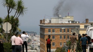
Friday’s scorching 106 degree heat in San Francisco broke the all-time record dating back to 1874 for the hottest day in the usually foggy city by the bay.

And that record may get broken by Saturday’s similarly hot temperature.

“It’s horrible out there,” Fritz Waldron said Friday as he stood in line to buy strawberry ice cream at the Haagen-Dazs shop at Westfield San Francisco Centre downtown. “Just horrible. It’s like Phoenix. I can’t wait for it to end.”

Before Friday, the hottest day ever recorded by the National Weather Service for San Francisco was 103 degrees on June 14, 2000. And the hottest Sept. 1 was a mere 90, a record set in 1952.

The National Weather Service advises Bay Area residents to stay hydrated and stay indoors during this unseasonably warm Labor Day weekend. Photo: National Weather Service / / National Weather Service The National Weather Service attributed San Francisco’s blazing heat and other falling records around the Bay Area to a “massive area of high pressure” hovering above Northern California and no onshore wind, which usually brings cooling sea air into the city and other coastal areas. It issued an excessive heat warning through 9 p.m. Saturday along the coast.
 
Tonight
A 20 percent chance of showers and thunderstorms. Mostly cloudy, with a low around 81. East wind 5 to 10 mph, with gusts as high as 20 mph.
Sunday
A 50 percent chance of showers and thunderstorms. Mostly cloudy, with a high near 89. Light and variable wind becoming east 15 to 20 mph in the morning. Winds could gust as high as 30 mph.
Sunday Night
A 30 percent chance of showers and thunderstorms before 11pm. Mostly cloudy, with a low around 66. Southwest wind 5 to 10 mph becoming light in the evening.
Labor Day
Mostly sunny, with a high near 88. Light and variable wind becoming southwest 10 to 15 mph in the afternoon. Winds could gust as high as 25 mph.
 
They're calling the LA County fire a disaster, they can't get it out---until this rain started. I'd say if they got as much as we got here it's gotta be out now.
 
http://www.ssd.noaa.gov/goes/west/tpac/h5-loop-ft.html
Tropical east Pacific unusually quiet for this time of year. Quite the contrast to the Atlantic. :shock:
Looks like a La Niña thang.
http://www.goes.noaa.gov/HURRLOOPS/atir.html
 
Today
A 20 percent chance of showers and thunderstorms before 11am. Mostly sunny, with a high near 87. Light and variable wind becoming southwest 5 to 10 mph in the afternoon. Winds could gust as high as 20 mph.
Tonight
Partly cloudy, with a low around 66. Southwest wind 5 to 10 mph becoming light and variable in the evening.
Tomorrow
A 40 percent chance of showers and thunderstorms, mainly after 11am. Mostly sunny, with a high near 89. Light and variable wind becoming southwest 5 to 10 mph in the afternoon.
Tomorrow night
A 40 percent chance of showers and thunderstorms before 11pm. Partly cloudy, with a low around 68. Southwest wind 5 to 10 mph becoming light and variable in the evening. Winds could gust as high as 20 mph.
Monday
Sunny, with a high near 90. Light and variable wind becoming southwest 10 to 15 mph in the morning. Winds could gust as high as 25 mph.
 
http://www.wrh.noaa.gov/lox/scripts/animate.php?root=radar_cr&list=VTX_7.png,VTX_6.png,VTX_5.png,VTX_4.png,VTX_3.png,VTX_2.png,VTX_1.png,VTX_0.png

http://forecast.weather.gov/wwamap/wwatxtget.php?cwa=lox&wwa=special%20marine%20warninghttp://forecast.weather.gov/wwamap/wwatxtget.php?cwa=lox&wwa=special%20marine%20warning

Very unusual for possibility of waterspouts during this time of year. :shock:
 
----------------------------------------------La Niña Rain Gage-------------------------------------------------
Nothin'/Skunked-Foggy Doggy-Play Misty-Drizzle Corn-Light Showers-Steady Soaker-Bands/Sheets-Cats & Dogs
------ :twisted: --------------------------------------------------------------------------------------------------------

Most of it going to the Channel Islands and the North Coast.
http://forecast.weather.gov/wwamap/wwatxtget.php?cwa=sgx&wwa=special%20marine%20warning
 
Back
Top