Most scenic bike paths (for recumbents) in the southwest US?

parajared

10 kW
Joined
Apr 16, 2012
Messages
858
Location
Northern Arizona
I'm gearing up for a road trip somewhere scenic and I am looking for a smooth, groomed recumbent friendly "urban pathway" somewhere; no shoulder of the road stuff. I enjoyed Prescott's Peavine trail and Flagstaff's urban path system (pics below) and I am looking for something similar. Looking at Utah, Colorado, New Mexico, Nevada, and South California for some epic spring time riding.

Anyone run all 50 miles of the Jordan River trail in Utah?

Prescott Az
PV-bike.jpg

7.jpg


Flagstaff Az
20131026_095311.jpg
 
Funny, when I read your title I was going to recommend the Peavine around Watson Lake in Prescott.
We like to ride the new trail in Laughlin NV upstream from the casinos to Davis dam. You can follow the road at the north end and ride across the dam but you have to get around or under a gate that blocks cars from the dam. On the other end of the dam there is another gate near the visitor center that is even more difficult to get around. If you can negotiate those two obstacles you can make a loop from Katherine landing road to the highway and across the bridge back to casino row.
 
Yeah Peavine is pretty awesome. From Prescott valley (glassford hill road) to the scenic overlook at Willow Lake is 13 miles making for a nice little 26 mile out and back.

They just installed a new trail making so you can get to WIllow lake now. You cut through the Watson Lake park and cross highway 89 at the roundabout.
107_new_path_1.jpg
 
Most of that stuff I talked about in the PM is shoulder of the road. With that pickup truck flicking your elbow going by at 70 mph of course. Part of why I went longtail, no trailer, full suspension for that inevitable ride into the ditch.

Albuquerque bike paths are pretty nice, but not hugely scenic. Same with the trails in Las Cruces. Putting up with the cars on the road to the Sandia crest will be worth it though. Do it on a weekday of course.

And the long cut to Golden is a nice ride, with nearly no cars. State road 344. All the traffic is on the main road, through Madrid. Ride it south to north, or you climb 18% over the mountain. The south side is only about 6-7%.

The stretch of state road 1 between Monticello and Ft Craig that follows I 25 is plenty empty any day of the year. It will ride like it's a bike trail. I think I saw two cars in 40 miles. Emptiest road in NM, that's paved.

If you circle past here, I have a local road to nowhere you might like. Desert scenic, ( some will think ugly) with a ball buster of a climb to a mountain top at the end. A favorite for local lycra road riders, with very few cars ever. Surface a bit crusty. Perfect place to run a flash crowd death race. And of course, the bike trails in town. Spectacular view of the nearby Organ mts from town, that we ignore too much.

And if you go to the Gila, even though it will be full of cars, the road from Silver City to Pinos Altos is so packed with bike riders year round that the cars are well trained. Very nice ride, from desert to the pines. Silver is a bit like Bisbee, the southern Santa Fe of NM. Again, go during the spring bike race, Tour of the Gila. The crit around downtown is a hoot to watch. Eat at the Mexican place on the very north end of the downtown, hidden behind the thrift store.

One ride I'd love to do, would be Bisbee to Silver City. Most of it on a back route that has nearly no traffic. You'd need serious range to do it. Really riding through empty desert. No guarantee of finding a friendly plug. With a driver following, I could bring a generator. Or do it both ways, a section at a time returning to the camp and the generator.
 
I am looking at maybe working my way north along the California coastline.
Anyone out there do any of the following rides:
Bayshore Bikeway in San-Diego
Ojai Valley/ Ventura River in Ventura CA
Monteray Bay Costal path South of San Francisco
Iron Horse Regional East of San Francisco
Sacramento River trail
Bizz Johnson trail
 
The American river trail is 37miles end to end. There's areas of the trail that are more urban and lots of homeless folk but most of the trail is beautiful.

It begins at Folsom lake which is allright. Not stunning but its nice. Then it descends for a while going down the backside of Folsom damn. Very neat scenic spot that allows you to see the floodgates as well as some of Folsom prison. A nice descent to thats fantastic fly down and is a steady for a few miles.

That floodgate flows into lake natoma which is smaller then Folsom but prettier imho. It follows lake natoma for a few miles then you pass the damn which has a fish hatchery that's neat to see when salmon run.

Then it follows the American river for a good while. Very beautiful and nature filled at first but as you approach the city of Sacramento it starts to look more like Chicago LOL.

Its all nicely paved with plenty of dirt trails to play on.


Is it a must see??? Maybe I take it for granted cause I grew up. Id rate it a 5 out of 10. If your there hit it but I would not say its worth a 6 hour detour. I'd stick to the coast myself.

Adam
 
I've ridden the California coast from Eureka to Santa Barbara.

Consider going north to south -- work with the prevailing winds, not against.

How are you going? Full packs and camping? By car, hotel and unladen rides where you find good roads?
 
The American river trail is 37miles end to end. There's areas of the trail that are more urban and lots of homeless folk but most of the trail is beautiful.
The American river trail looks pretty cool. I may end up working my way that far north. From the reviews I read online it looks precisely like the sort of thing I am looking for.
How are you going? Full packs and camping? By car, hotel and unladen rides where you find good roads?
Roads with with light traffic and nice wide shoulders can be fun, but I feel the car hating crabby ol' curmudgeon coming out when the shoulders get skinny and the traffic volume gets high; the noise the fumes, the cars missing by mere inches. I am hoping for some epic bike paths away from traffic. I don't know of any 1000 mile long bikeways or anything; bike paths tend to only be about 20 miles long or so and spread out a bit (usually by skinny high car volume roads) so out and back stuff sounds best. Do the ride, return to the car, then drive on to the next path system.

Probably going to go for the tent camping route and a couple of weeks of riding.
 
Well . . .
That makes a pretty big difference and opens up a lot of possibilities. My understanding, perhaps wrongly, is that recumbents aren't so great for hill climbing. Don't know if it's really true or if you've got e-bike capabilities, but that could make a difference, too.

Have you at least considered Yosemite? Once you're to the valley floor it's pretty much flat and, really, everyone should see it at least once in a lifetime.

Santa Ynez Valley is nice and gives you a bit of the wine country without the crowds of Napa Valley.

Much to most of the coast is unrelenting hills. Try Morro Bay, Monterey Bay or San Francisco Bay and you'll have some very nice flat-ish coast ranging from what Steinbeck probably saw, to what Monterey has become (though the Pebble Beach area is spectacular) to bike friendly metro (try the Crissy Field area).

Pretty much, if hills are a factor, look at places that are tagged as bays, valleys or rivers and you can be fairly assured of more level terrain.
 
The coast has got to be more scenic than any riverside bike trails along the Rio Grande. NM and AZ have scenic by the boatload, but the road is always narrow, and no ridable shoulder.

Like I said, it's why I went the way I did, a bike that can ride into a ditch if I must, with camping gear loaded on. I keep looking at maps, for roads nobody will be driving on.

What about just riding roads in Southern Utah? Bryce, Zion, Escalante. You know the traffic count won't be nearly as big as the south rim of the canyon. Just too far from the main routes for 90% of tourists, and not that many locals.
 
Snow Canyon in North St. George is beautiful in the spring and fall. There's a single paved road that runs down the middle of it. Probably too short to make a special trip for just that, but as long as you're just passing by...why not?

St George is the last city in the low desert near Las Vegas / Mesquite as you head north...same weather. Just north of there you climb up into the high plateau where Salt Lake City is...nicer summers, brutal winters up there, the opposite of St George.
 
On the way to California, you might want to try Valley of Fire outside of Las Vegas. You can camp there and every time I've been, it seems like I'm one of only a half dozen folks.

http://parks.nv.gov/parks/valley-of-fire-state-park/

(If you do contemplate Yosemite, check into reservations right now . . . it books up that fast.)

As you start to solidify your plans, I'm sure that many of us will be able to point you to some of the weird and the wonderful:
http://en.wikipedia.org/wiki/Madonna_Inn
 
It's a very nice ride, but the part I've ridden, Montano south through to the end, doesn't really ride you through the cottonwoods like I wanted it to.

Is it nicer north of Montano? Or does it just follow the ditch on the levee top some more?

Here in Cruces, and on other trails close to El Paso, the trails are down inside the levee. But there is no bosque down here. Just grass, weeds, and occasional trees. The river is a dry hole, it will be running only for a few weeks in June this year, again.

I thought the really nice rides in the Albq area are on the east side of the Sandias, and another good one is from Belen south to La Joya. Particularly the last section from Boys Ranch to La Joya. Descending from Sedillo to Albq on old 66 is not a bad ride too. But none of that on trails of course.
 
Has anyone explored the south rim of the Grand Canyon? Bicycles are not allowed below the rim (obviously), but I understand that there are some roads along the rim that are closed to vehicles but open for bikes.
I may have the opportunity to spend the summer as a camp host at GC village and I'm kind of excited at the prospect of biking around the park in my spare time.
I have not found any information about restrictions on e-bikes in National Parks but would appreciate hearing about other's experiences.
 
While the OP may be looking for something different, I thought I'd post some links to the Albuquerque river trail for people who search this thread and would like more info. If you're here for the balloon fiesta and want to do some biking this is definitely something fun to try.

Ideally I may end up doing well... everything. Albuquerque sounds awesome because I am also a pilot and I would love to toss my paraglider, and my motor in my trunk and go fly with the balloons. This would likely be an entirely different trip however (Spring 2015?).

Bryce and Zion offer some rather striking scenery, some of the best I've seen in Utah. I have on several occasions looked on in envy of the folks riding that trail. Maybe a Jordan river/ Bryce area run?

Has anyone explored the south rim of the Grand Canyon? Bicycles are not allowed below the rim (obviously), but I understand that there are some roads along the rim that are closed to vehicles but open for bikes.
I may have the opportunity to spend the summer as a camp host at GC village and I'm kind of excited at the prospect of biking around the park in my spare time.
I have not found any information about restrictions on e-bikes in National Parks but would appreciate hearing about other's experiences.
I live in AZ and run up to Grand Canyon every now and then. I have had no luck with bicycle trails that are much good. Theres a few rather piddly paths for bikes that are away from the views. All the best views of the canyon that I have found are hiking/wheelchair/equestrian only.

The woods by the villiage are ok; but I think Wiilliams, Flagstaff, and Sedona are way better for mountainbiking.
 
dogman said:
It's a very nice ride, but the part I've ridden, Montano south through to the end, doesn't really ride you through the cottonwoods like I wanted it to.

Is it nicer north of Montano? Or does it just follow the ditch on the levee top some more?

Here in Cruces, and on other trails close to El Paso, the trails are down inside the levee. But there is no bosque down here. Just grass, weeds, and occasional trees. The river is a dry hole, it will be running only for a few weeks in June this year, again.

I thought the really nice rides in the Albq area are on the east side of the Sandias, and another good one is from Belen south to La Joya. Particularly the last section from Boys Ranch to La Joya. Descending from Sedillo to Albq on old 66 is not a bad ride too. But none of that on trails of course.

It's pretty much just more of the same north of Montano. There used to be some beautiful paths that ran parallel to the paved path that went through the trees but it got destroyed after the big fire that ripped through there several years ago.
 
I expected that. On the other hand, if a fire rips through our bosque, all that will burn is a lot of tumbleweeds. :roll: 
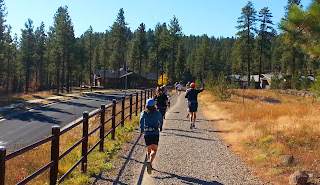
Our bosque is only scenic compared to trailer parks. But it's still a fine ride on nice trail.

The Albq bosque trail is still a lot more scenic than the one along the ditch that passes the Fiesta Field. It's definitely worth a ride if you are in town. But for scenic, ride the road to the crest of the Sandias on a nice weekday with low traffic. Also mentioned before is that road 344 from Edgewood to Golden. Low traffic on that one too. Descending the canyon on old 66 is fun, but VERY high traffic.

Flying with the balloons would be fun. Same good flying weather would be perfect for a paraglider, and a good balloon launch should be adequate to get a powered kite aloft. They used to hang glide off the crest a lot, but I didn't see a built place to launch them when I was on the crest last summer.

If you want to fly with balloons during the Fiesta, it's a no go. Fiesta gets an FAA waiver, that means they "own" the airspace for a 5 mile circle around the field. But any fall weekend, balloons fly from other places, and on those days it's regular airspace. Maintain a safe distance, and most pilots I know would think you were cool. Know that balloons have the right of way above, when they can't see you. So don't fly close over the top and have one suddenly climb into you.

BTW, living in AZ, you already know that late summer or fall is the season to ride "scenic" I rode the south valley below Belen last summer not long after the big flood. All the wildflowers were at their peak, all the way from Socorro to Belen. It was gorgeous. Also beautiful would be fall color, like 4th of July campground or Cloudcroft in late September or Oct. Spring is likely to be a haboob, just like in AZ.
 
Just to chime in on the ABQ scene . . .

Above Montano is a bit more scenic, but if you can tolerate a bit of traffic and make your way to the village of Corrales, it's pretty nice, too. They have a pretty strong horse culture, so they are attuned to the unexpected in the road and are very obedient to the village speed limit. (As a sort of related side note, there is litter all the way up to every national park I've been to, but just outside it stops dead . . . no conspicuous litter patrols, just a change in attitude and behavior, I think.)

There is a good, if somewhat wishful, map of the trails here:
http://www.cabq.gov/gis/map-views/bike-paths-route

Some paths are still works in progress, but it's a pretty solid map. I'd be very careful of fast streets around here. Very poor driving, on the balance. Any dedicated bike paths, however, are safe and fast and fun.
 
That link went to page not found, but I could still click on a link to the page with the bike map. Click things to do, then click bike.

We have a similar map for Las Cruces. It lists some streets with bike lanes only a complete fool would ride on. Does not list the network of irrigation ditches that had been our bike paths for a lifetime. :roll:

The point is, grab one of us locals if you come here to ride. :mrgreen:

There are lots of dirt routes not on any map that rock in my town. Combine those with the existing paved multi use paths, and you can have a nice ride with cars only at road crossings. And low traffic streets not on the bike route maps that are superb bike routes. My neighborhood is full of such places, part of why we chose the house.

Scenic depends on your POV and attitude. They are trying to make the Organ mts a national park. They are 6 miles from my house, and any look that way is scenic, even when looking from the walmart parking lot. Most would agree that's scenic. But to my eye, the junky old casas in the valley are also New Mexico scenic. The best road I ever biked in NM though, is just the old highway by Nogal Canon. 2 cars an hour, and nothing but desert. Lots of prettier routes, but none better on the bike.
 
Not especially a bike thing, but a scenic thing in the Southwest.

Many years ago today, I stood near the rim of Meteor Crater near Winslow Arizona. That is a spectacular big hole in the ground!! And be sure to notice the gigantic 100 foot by 20 foot chunks of bedrock left over from the explosion. I read an estimate one time that it was the equivalent of a 200 megaton explosion.

And another scenic scene, whether by bike or car. If you are approaching Las Vegas from the South you come to a crest and then its a continuous downhill run of a good number of miles into Lost Wages. When you do it at 2 in the morning you have a long, long scene of the ever changing pattern of city lights as you are on your glide path. If you dont remember to think about the money you might leave behind on the roulette tables, you have a chance to enjoy a beautiful scenic spectacle.
 
Well, reservations have been made; I am heading to Colorado first to do the Animus river trail. I am thinking next trip (fall timeframe maybe) will be the ocean (Bayshore/Ventura River/Iron Horse/Sacramento) and then maybe Snow Canyon, Red Canyon and Jordon River in Utah next spring. I will post pics after these rides are done.

When you do it at 2 in the morning you have a long, long scene of the ever changing pattern of city lights as you are on your glide path.
Yowza! :shock: That’s some rugged biking there. I prefer to be sleeping at 2am

..Meteor Crater near Winslow Arizona. That is a spectacular big hole in the ground!
I forget sometimes how subjective a term like “beauty” is.
meteor crater
Arizona_004.JPG


On the way to California, you might want to try Valley of Fire outside of Las Vegas. You can camp there and every time I've been, it seems like I'm one of only a half dozen folks.
Good suggestion; I have been there before, very scenic
 
I'm green with envy. Retired early against my will, no money for anything more than one tank round trip away. I sure wish I could afford a long trip to go biking in Colorado and Utah.

If you did want to check out Albuquerque, the time to do it would be the first and second weekends of October. Real scenic in the AM when 800 balloons are flying. One of the bike trails goes right past the launch field. It used to be at the peak of the bosque fall color, but now global wierding has made it a bit early for the best color.

A few ES members in town, so a free place to stay is not impossible. The hotels get pretty full that week. I hope to be strong enough to be there.
 
Yeah sheesh, it's gonna cost a few bucks alright. It isn't the price of camping and food that's killer, it's the price of gasoline; my Honda Civic rocks 37mpg and it's still going to cost close to $100 in gas to go a state over and back. Hydrogen as a fuel source needs to hurry up and become viable.
 
Back
Top