Dear Diary,
Got up a bit late this morning; lil’ achy from yesterday and
the bum is smarting a bit. I was surprised though when I weighed in at 151.6 lbs. and here I thought I was thinking I’m heavy after that pizza yesterday. It’s been a long time since my weight was this low. Still can grab that ring of fat around the waste, so more work to be done in that department.
This is
The Day, the one where I can break 10,000 electric miles. I’ve got
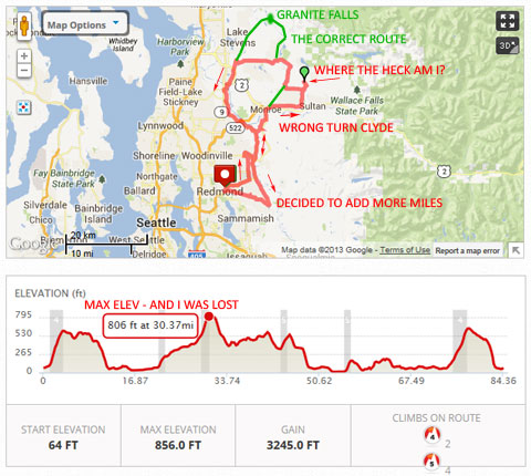
Granite Falls on the brain. No more chances of getting lost; the map is in my head and I’ve done covered most of what I don’t know. Once - many years ago I drove around the segment between GF and Lake Roesiger after a successful day trip to Monte Cristo… now that is a real destination:
Monte Cristo. It will have to wait for another day.
After yesterday’s ride – all I need is 67 more miles. But that just won’t do. It’s got to be
Granite Falls.
Last night I fell asleep with the charger on; it must have been clicking away for a couple of hours. This morning the pack reads 63.35V so I know it got a damn good trickle balance. I don’t have a BMS; this is as close as it gets. Sometimes I tear the pack down for inspection but I’m always surprised to find the cells are within
reasonable disparity (how’s that for an oxymoron). It’s 72°F right now at 9 AM; going to be a warm one today; breezy though like yesterday with winds out of the north. I better get moving with breakfast. Camera batteries are charging.
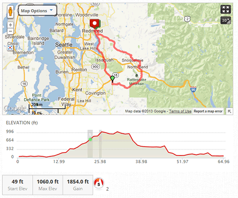
11:30 AM – I set out. Yessss, I know that’s really late! Pack voltage was at 63.35V using the 15S10P (50Ah) configuration. Headed out on SR 202/Redmond-Woodinville Road which turns into Hwy-9 as it leave north of Woodinville. Followed that all the way until the airport at Snohomish and took my first break at…
12:20 PM after about 20 hard miles at Maple & 2nd in the shade. It is very warm and humid. I was beginning to flush from the heat. Maple turns into Machias Road which I followed all the way to SR-92 which was about 10 miles. The road had ample shoulders up to about midway but then turned narrow and windy. At SR-92 again had to stop in the shade and cool down for 5 minutes. For a lil’ old highway ’92 sure was busy – and hot; my brain was beginning to bake.
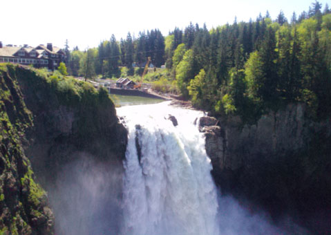
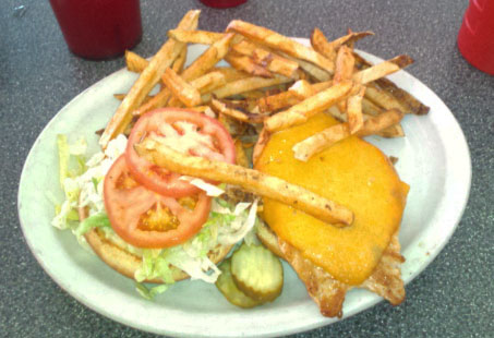
About 1 PM after 35 miles I rolled into Granite Falls proper and pulled off at a preselected place to lunch as I was plenty ready for a long break. My skin is turning red from heat as I was nearing exhaustion. Looked over the menu and decided pizza was too much and instead had the Chicken Caesar; it was nothing to write home about. They weren't busy; only one other table with a gaggle of old kind ladies finishing up their business. The waitress was attentive, though far from conversant. I tried three times to solicit information about the town and in return was the briefest of responses – the longest of which was her last, she says:
"I’ve been here for two years and I don’t care for it; I am moving soon." She took my money and promptly left. And just like that – I figured it was probably in the mutual best interest
for her and the town.

Granite Falls suddenly seemed to have more in common with
Frostbite Falls than Snoqualmie Falls.
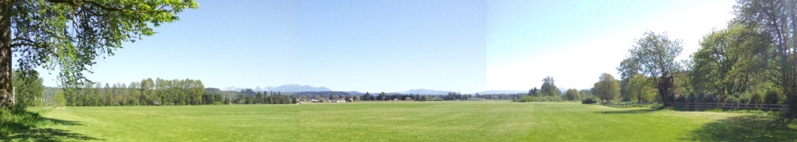
I too left at
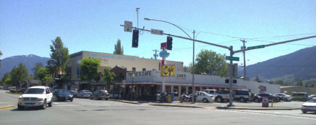
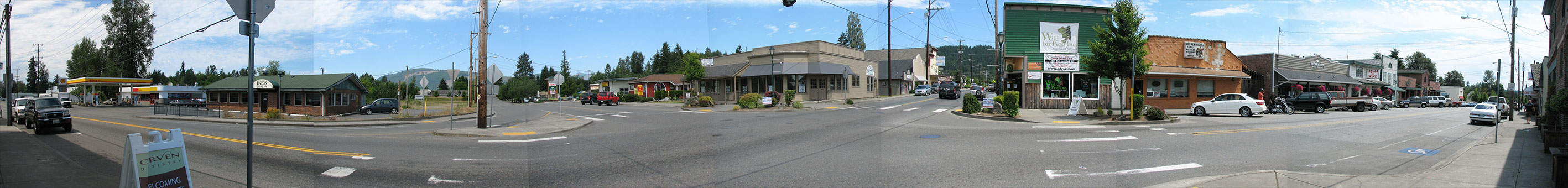
1:52 PM with 58.4V on the pack, and plenty watered. High clouds had just begun to form and cut some of the wicked sunlight back. I took a panorama from my location. The place where I ate at is probably ok – but I’ve decided not to name it. From the panorama – it’s the building NOT shown.
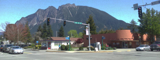
Granite Falls, Washington. I am standing on the SW corner, therefore Road directions L to R are West, North, East, South.
This is a really wide panorama: Full-sized image here.
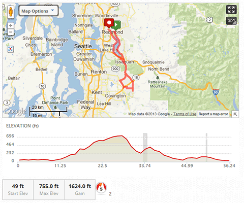
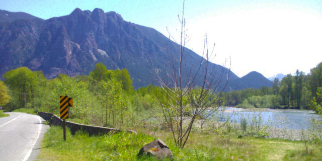
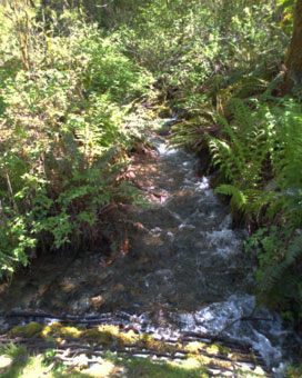
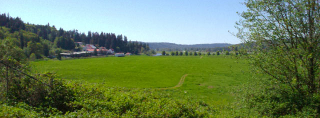
Leaving town was easy and I had it memorized. Took Menzel Lake Road which was truly a beautiful scenic ride under the canopy of 2nd generation growth shaded by afternoon sun. Definitely 10°F cooler – and no wind except for what I had made. All the way from Redmond to GF I had constant 7-10 mph headwinds; I kept my speed in check knowing it’s not worth fighting it. Now in the forest, it was quiet was hardly a dozen cars in either direction. Eventually this runs into Lake Roesiger Road named after a gem of a lake nestled between ridges – and what a crackin’ day to be on the lake! Unfortunately it’s well-marked out with private properties and not really one good spot to stop and take photos.
 Fishing info about the lake
About
Mile-46 I hit Dubuque Road; go right and I’d wind up in Snohomish. Go left – Monroe; I went left. Not nearly as scenic with some parts having been clear cut though not replanted. Fugly forest management by privateers. But I didn’t have to pedal much with the descent and arrived in Monroe at…
2:42 PM after 56.7 miles. As soon as I hit the river bottom the oppressive heat returned. Went into a Shell Minimart and bought some OJ. Drank a third and cut the rest with water. I really needed to cool off.
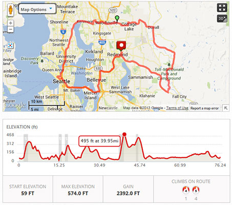
3:05 PM, left with 56.7V on the pack. At this time I began to conspire how to push the pack to the limit. Went south on SR 203 toward Duvall, but cut right onto Tualco|Crescent Lake Road which hooks up to High Bridge Road, and I go south. Once again I am under the shade of canopy by afternoon sun and the temp drops 10°F. Perfect for riding. The clouds are really building now. Most of the wind is from the north so I don’t feel it. Crossing the county line, the road changes names to West Snoqualmie Valley Road. I cross the W-D (Woodinville-Duvall) Road at 66 miles and keep heading south.
Yesterday at the pizzeria they told me WSV Road was closed farther south; I’d been on it twice in the last month – but they said it’s under serious repair and there’s no through traffic. Sure enough as I approach NE 124th there’s a sign that says it is
closed. This puts a crimp in my plans. The detour takes me back to SR-203 and I go south.
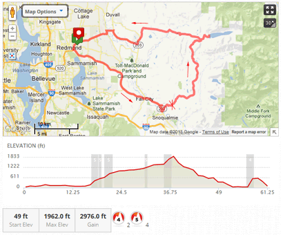
At the intersection of Stillwater Hill Road I am forced to stop (
Mile 74) to rest my throttle hand. It’s been a difficult day trying to use Cruise Control and I’ve got a cramp in my wrist from gripping. Watered up with the OJ-blend. Onward after about 5 minutes. Soon I approach the intersection of Carnation Farm Road and the detour says to head this way.
There are three choices to get back to Redmond and none are very good after the detour with 55.5V on the pack:
- Carnation Farm Road to Union Hill is the closest but hilly.
- Carnation Farm Road to Ames Lake to Redmond-Fall City Road is longer but less hilly.
- Tolt Hill Road to Redmond-Fall City Road is the shortest, but has the steepest hill climb; straight up to 500' and back down.
In retrospect it’s the last one I should have taken instead of the first, and even the middle would have been better. But I didn’t have a computer with me to figure it out, and the clouds were getting really dark with wind picking up. Halfway up Union Hill grade I had to downshift and nurse it slowly. My voltage dropped to 52V and I still had to climb. The only saving grace was the 9% downgrade into Redmond where I put almost a full volt back into the pack – but any of those routes would have done that. As I hit the bottom of my hill there was 51.0V and reached LVC exactly as I pulled off the road into my secret hidden urban bat cave at…
4:30 PM and 89.7 miles. After my shower the pack popped back up to 51.75V – but we know it’s tapped out. I have it on the charger now.
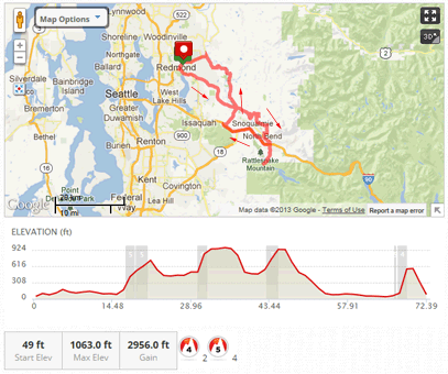
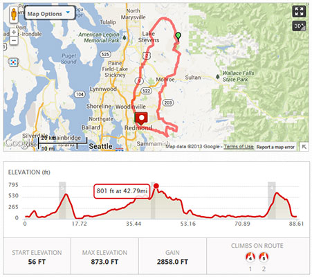
Fatigued but feeling pretty good. I’ve said it before that on level ground in the right conditions, that pack has 100 mile range. Maybe I need to plan a ride to prove it. So my final Odometer Reading for every ebike ride stands at
10,022.8 miles, of which 4,532.7 are 2WD.
I’ll have to put together the panniers and plan something really fun now, maybe an over-nighter! :wink:
Until next time Diary…
Happy Trails,
KF