
hjns
100 kW
Hi all,
Just wanted to share this with you. I saw some questions how to determine the grade of a specific hill. As most people now are close to any GPS-enabled phone, I thought I would post how I visualize the GPS track.
Pre-requisites:
Methods:
Enjoy!
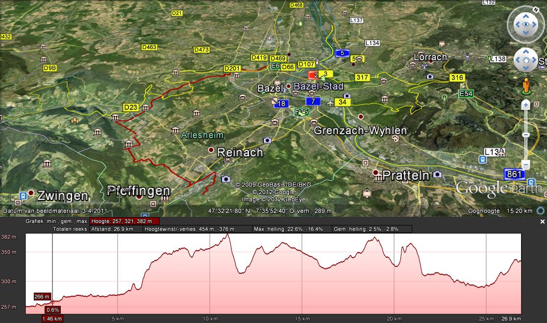
Just wanted to share this with you. I saw some questions how to determine the grade of a specific hill. As most people now are close to any GPS-enabled phone, I thought I would post how I visualize the GPS track.
Pre-requisites:
- GPS device that can log a track and output it as either an NMEA track or OziExplorer track. OziExplorer works for Windows Mobile and Android devices. The GPS-enabled CA-analogger logs GPS data as NMEA file.
- Google Earth installed on your computer
- Internet access
Methods:
- Export the GPS track file.
- If NMEA track, convert it to OziExplorer track using this converter.
- OziExplorer plt files can be converted directly to Google Earth paths.
- Thus convert OziExplorer track to Google Earth path (kml) using this converter.
- Open Google Earth. Within Google Earth, open the kml track. Right click on the opened path to edit the properties.
- Open the altitude graph in Google Earth.
- Move the mouse pointer along the track to the place where you want to know the inclination (in %) and you will see it.
Enjoy!