la Nina rears her ugly head

La Niña Rain Gage
Nothin'/Skunked-Foggy Doggy-Play Misty-Drizzle Corn-Light Showers-Steady Soaker-Bands/Sheets-Cats & *******************************************************************:)

Got 0.06” as of 06:00am.
 

Detailed Forecast​

Tonight
Partly cloudy, with a low around 54. Southwest wind 5 to 10 mph becoming light west in the evening.
Monday
Patchy drizzle and fog before 11am. Mostly sunny, with a high near 74. Light west wind becoming southwest 5 to 10 mph in the morning. Winds could gust as high as 20 mph.
Monday Night
Patchy drizzle and fog after 11pm. Mostly cloudy, with a low around 50. Southwest wind 5 to 10 mph.
Tuesday
Patchy drizzle with a slight chance of showers before 11am. Patchy fog before 11am. Otherwise, mostly sunny, with a high near 72. West wind 5 to 10 mph, with gusts as high as 20 mph. Chance of precipitation is 20%.
Tuesday Night
Patchy drizzle and fog after 11pm. Increasing clouds, with a low around 51. Southwest wind 5 to 10 mph.
Wednesday
Patchy drizzle and fog before 11am. Mostly sunny, with a high near 74.
Wednesday Night
Patchy fog after 11pm. Otherwise, partly cloudy, with a low around 52.
Thursday
Patchy fog before 11am. Otherwise, mostly sunny, with a high near 79.
Thursday Night
Patchy fog after 11pm. Otherwise, partly cloudy, with a low around 54.
Friday
Patchy fog before 11am. Otherwise, mostly sunny, with a high near 80.
Friday Night
Partly cloudy, with a low around 55.
Saturday
Mostly sunny, with a high near 76.
Saturday Night
Mostly clear, with a low around 54.
Sunday
Sunny, with a high near 71.
 
La Niña Rain Gage
Nothin'/Skunked-Foggy Doggy-Play Misty-Drizzle Corn-Light Showers-Steady Soaker-Bands/Sheets-Cats & *********************************************:)
They tell me you could be in for 6 inches this Sunday/Monday.... :oop:
 
Last edited:
It's missed me here the last couple days, though before that we got drenched pretty good the one night.

Looked like it was going to do it again tonight from the look of the clouds as I was heading home from work (with an unsuccessful pitstop at goodwill to see if they have any microwave ovens, since mine blew up last night). But it swerved west before it reached the valley. Still a chance that the one coming up from east of Tucson could reach us between now and morning, but I won't hold my breath.

Tomorrow ahs even more chance for rain, and if we get it probably at least as much as we got the other night...I'm hoping it doesn't hit us until *after* I get home, as I have to try goodwill again for the microwave hunt.
 
......

Tomorrow ahs even more chance for rain, and if we get it probably at least as much as we got the other night...I'm hoping it doesn't hit us until *after* I get home, as I have to try goodwill again for the microwave hunt.
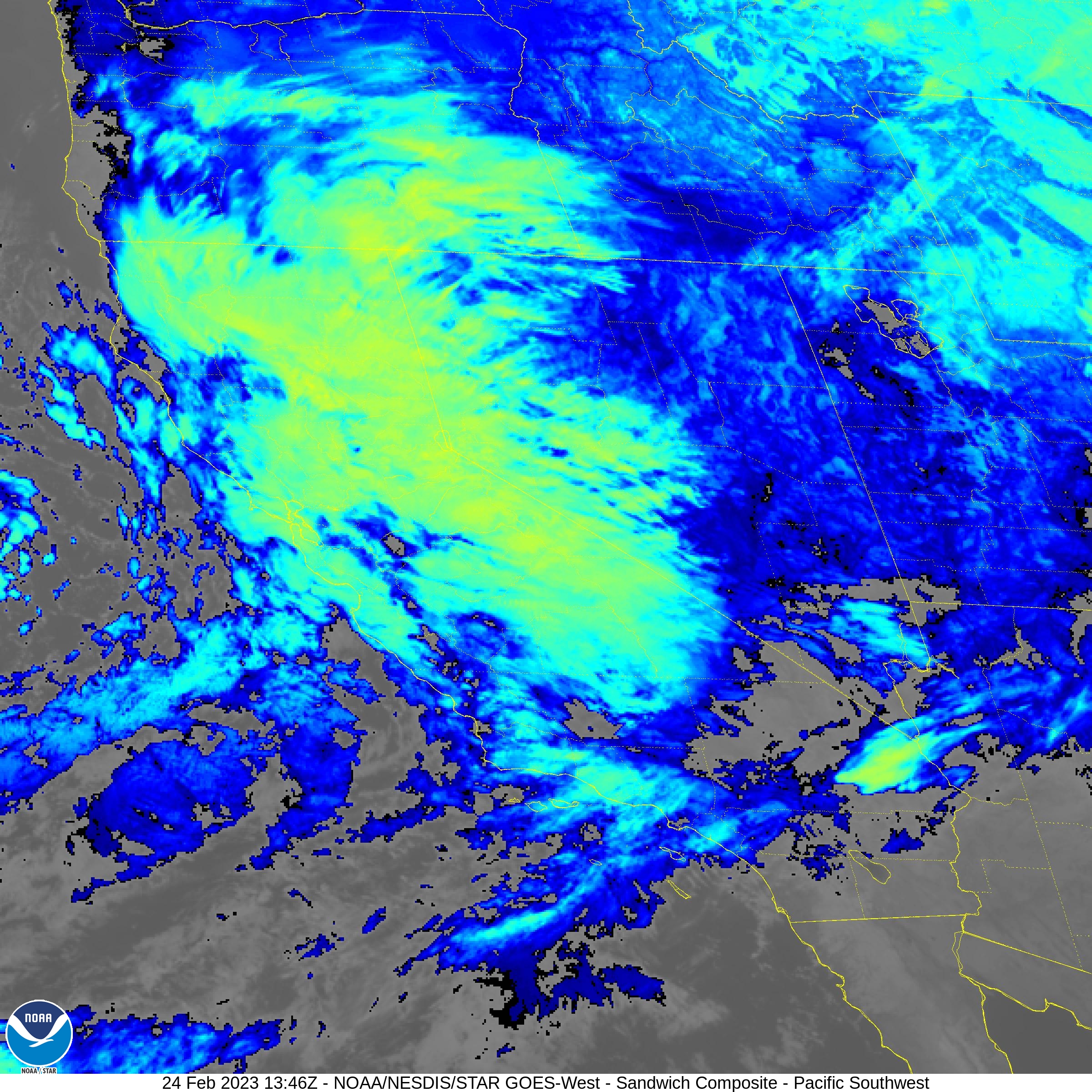
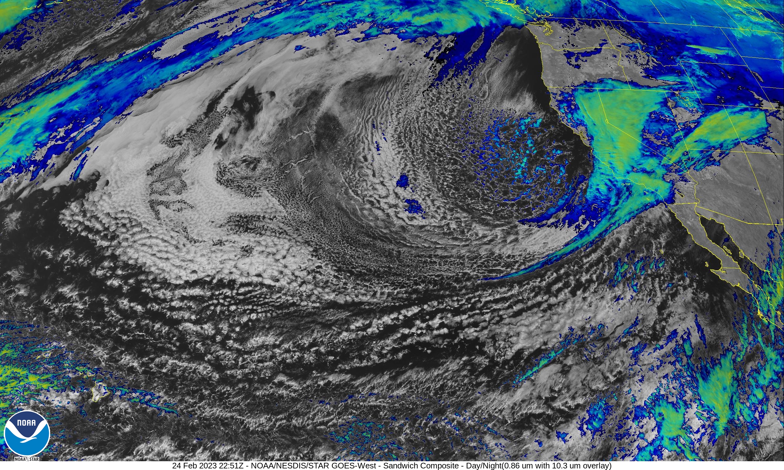
Here is what they are talking about this morning...
8-19 to 24 rain.jpg
 

I remember this one back in 1972. People were boarding up windows along the coast. We got no rain or wind but the surf was glorious.​


Hurricane GwenEdit

Category 3 hurricane (SSHWS)
DurationAugust 22 – August 31
Peak intensity125 mph (205 km/h) (1-min); ≤941 mbar (hPa)
On August 22, a tropical depression formed from a disturbance. It immediately strengthened into a storm and was named Gwen. Gwen moved generally northwest, paralleling the coast of Mexico, and intensified into a hurricane on August 24. It then spent a few days heading west-northwest before resuming its original course. The hurricane became a major hurricane on August 27. After retaining that intensity for over a day, it rapidly weakened. Gwen became a tropical storm on August 29, weakened into a depression the next day, and dissipated just after that. Hurricane Gwen caused some concern for high surf in California, including a forecast for storm surge, but only the high surf materialized. Hurricane Gwen caused no deaths or damage.[4]
 
Back
Top