On the Road | Going to California

what a great trip tale,that made my night.thanks for sharing. :D
 
beast775 said:
what a great trip tale,that made my night.thanks for sharing. :D

:D There's more - the best part is coming up very shortly!
~KF
 
Departure Day.
I once had a plan to take two days to get to Sacramento as a fail-safe option; split the load into two 80-mile jaunts with Nevada City-Grass Valley as the overnight weigh-station. But, like the rock Band AC-DC once wrote in a song, “I have big balls”, for I certainly have no fear.

What did it matter? I waited too long, perhaps intentionally, to place the razors edge right in front of me. For what better defines a challenge than the one that cannot possibly be met by any normal mortal? Certainly not by a couch potato, nor by the weekend wannabe sporting a new lycra outfit. My lycras are worn, almost shoddy, and I wear shirts with holes in them because I put them there, through sweat, through angst, through the crucible of proof that says I can do it! :wink: :)

It has been calculated that the distance between where I am and where I need to be is 160 miles; I believe I can do it in one day. Probably not on one charge though as I do not have enough data. There’s really only one way to find out: Baptism by fire! :twisted:

6:35 AM – Topping off the batteries prior to the long day that awaits, and wrapping up the little details. Time seems to slip away quickly.

8:03 AM – Off to late start. Ate two portions of oatmeal, lots of cantaloupe, and one cup of coffee. My Ma is pissed when she found out I have to get to Sacramento by midnight. I guess it’s the providence of mothers to worry. My Pa is more stoic; he understands, offers help if I want it, but doesn’t question.

Starting Stats: Batts = 63.2V, 284.7 mi, 144.4 Ah. I’ll leave within the next 10 minutes.

Map-GoldLake.png

Map: Morning segment from Johnsville to Downieville

Time? 287.0 miles, 62.8V. I am at the end of the naughty nasty wicked dirt road. I am never bringing this ebike back here; it is not suited for this terrain. P1 can do it though; next year perhaps. On the way out I was unseated once by the severe pogo effect up a steep rocky section and I was forced to push the bike up through it; got back on and headed on out with more throttle.

Inspecting the bike for damage, I thought I had a slow leak-puncture through the front tire; it is sitting in a wet spot, and the wetness is slimy like the sealant. I could be hosed before I get started! Examining closer, I can’t find a hole within the wet area on the tire. Hmmm, inspecting the ground, there are a few more wet spots on the pavement. They are fresh. Bah! Got it: Two RVs are parked farther down the road running their AC; there’s a dribble path of wet spots leading towards them; feeling and smelling - it has to be radiator fluid. Bullet dodged. 8)

On this leg of the trek I tied the daypack to the front of the bike to reduce stress on my wrists and hands; the bag came loose on the dirt road and I am retying it so it won’t rub the front tire. OK, one big long and steep downhill coming up: Let’s see what Regen can do!

EurekaSP0.jpg

Eureka Peak, historically imfamous!

EurekaSP1.jpg

Panorama: Between this ridge and the next is the Middle Fork of the Feather River. Beyond those hills lies a great expanse of high desert, volcanos, and drought.

Time? 294.8 mi, 62.2V, 147.8 Ah. At the junction of Hwy 89 and Gold Lake Road. Sign here says Truckee 47 mi, Gold Lake 7 mi, and Downieville 31 mi. I picked up about 0.5V coming down the Eureka-Johnsville Grade ~ that’s pretty good: Every little bit helps.

GoldLakeRd1.jpg

At the foot of the biggest hill-climb of the entire trip.

GoldLakeRd0.jpg

Humorous: When you see a sign like that, and I saw many since Burney, it means that the locals hate cyclists, and that the cyclists act like dipshits. :roll:

Time? 302.7 mi, 60.2V, 156.3 Ah. At the crest of Gold Lake Road/Plumas-Sierra County Line. This is close to the maximum elevation that I’ll reach for the entire leg; the road drops into a little bowl carved out by glaciers which now forms Gold Lake, and the other side of the rim is slightly higher: 6684 feet. I let the motor cool off. Had to make a small mechanical adjustment to the rear brake pad; the rear tire is so out of true that it is rubbing the left pad. In loosening the steel wire I have almost no rear brake to speak of.

GoldLakeRd2.jpg

Looking north... This was 8 miles of straight-uphill climb, over 2600 feet.

GoldLakeRd3.jpg

Looking south...

11:15 AM – Sierra City. Stopped for food: Banana, Chocolate Milk, Cliff Bar. I am way late; now two hours behind schedule. :oops: On the back side of Gold Lake Road, about at the Salmon Lake Rd turnout, I stopped yet again to inspect the rear tire which was rubbing pathetically against the rear brake pad – only to discover that I now had two broken spokes. I don’t know when this happened. Was it caused by Amtrak, or when I was run off the road by the dirt bikes, or when I came out this morning? It doesn’t matter; I have 34 good spokes left and I believe I can still make it. Regardless, I now have to disconnect the rear brake altogether as it was interfering with my Regen. While I am doing this a no-see’m bites me on the lip and it goes numb for about ½ hour. I really hate those little buggers; I’ve been swimming in Deet since the 3rd. :x

GoldLakeRd4.jpg

Panorama: Sierra Buttes dominates the view. My brothers rode their Mtn bikes from the top of this ridge down to Sierra City the previous week; I didn't bother going with; I have my own adventure to follow. :wink: Looking SW, that canyon below is where I am headed.

Stats so far: 315.8 mi, 60.1V, 157.1 Ah. I made up some slight voltage coming down the hill into town. Resting for about 20 minutes as I have my first big snack of the day, I am sitting next to some dude tapping away on his wireless tablet. He starts asking me questions about the bike, where am I going, blah blah. I tell him I’m going to Sacramento today. He begins to tell me the way to go – through Marysville which he clams is “more pretty”. Nope; I tell him I’m taking 49 all the way to Auburn. He says to me that’s madness and I’ll never make it to Sac today. I tell him it’s better than the hot anvil of the Valley floor dealing with a cross-wind on some boring back road. He says the way I’m going is dangerous, that folks up here don’t like bicycles blah blah. Then he says he’s biked all over the world blah blah, to Tibet, never broke a spoke, across Africa blah blah, Europe blah, and next week he’s going to bike the Arctic Circle blah blah. I say good bye to Blah-Blah Man. :roll:

12 Noon – Downieville, pee break. 328.5 mi, 59.4V, 159.7 Ah. Been mostly a pleasant downhill with light traffic. It is definitely warming up! I don’t doddle long.

Downieville0.jpg

Panorama: Charming little town. I came in over the bridge to the right. This view faces north-to-east.

Downieville1.jpg

...and I will be heading out in this direction momentarily. This view faces west; both were taken from the same corner.

Note: The panoramas may be clipped off, so just view the image properties and try to open them in a seperate window :wink:

Next up, the afternoon ride.
 
2 PM – Nevada City, food break: Chocolate Milk and Water. 371.9 mi, 56.7V, 180.4 Ah. It is very hot! Climbing out of the Yuba River gorge was easier than I had expected; I had began to face a slight headwind leaving Downieville, but cruising up the south side of the gorge, that headwind crossed over the river and became a welcoming cool breeze on the partly shaded up-climb. What I didn’t anticipate is that the next two rivers would be such a deep and steep climb out. On the flip-side, I was now out of the wind much of the time and I had some success with regen. Still – I am now at the halfway point with less than half the battery - so I am a tiny bit concerned. The Market where I stopped in Nevada City has all sorts of undesirables hovering about asking for a handout; need to boogie – no time to stop and chatter with these people. :roll: My head is a little light from the heat but I need to push on.

Map-Downieville-Auburn.png

Map: Afternoon leg, from Downieville to Auburn

Time? Arrived at a friendly-acquaintances’ ranchette about 3 miles off of Hwy 49 several miles south of Grass Valley. My folks arraigned this rendezvous for me out of concern. There is no one home so I quickly took assay of power and water being short of both: Found the power and immediately plugged in.

Stats: 395.8 mi, 55.5V, 191.1 Ah.

In review, I became a little lost going through Grass Valley and had to ask for directions twice. In a hasty maneuver, the rear tire took a hard bump and I broke two more spokes: This concerns me. :| A few miles before this happened I rode past a bike shop; should I turn around and go back, or go forward? Mantra: Have No Fear. I went forward. :wink: Some guy pulls up beside me and swears that my rear tire looks like it’s going to fall off. I tell him I know and I drive slow until he’s out of sight, then I ramp it up and cruised at 26 mph, taking corners slowly to counter the rear-overdrive-mind-of-its-own-wobble effect. After I merged back onto Hwy 49 south of where it becomes freeway, I’m cruising along thinking I’ve got this under control when all of a sudden the rear tire starts making an evil racket. Crap. Pull over, get off, inspect and there is this ugly piece of twisted wire bonded to my rear tread. I pull the wire out and toss it. Crap! Ohhhh ~ now I want to take a picture of it! :lol: Well... <kick pebble> Quickly I roll the bike backward to seal the leak (I have the Specialized Desert Tubes filled with Slime-equivalent); after 30 seconds – no more leak. <Sigh, nods, good!> :wink: Get back on the bike, and get going again.

Now I’m here sitting in front of an empty house some 20 miles later thinking about tapping a faucet – when the person I am suppose to meet pulls up in his SUV; his real name is different so let’s call him Bob.

After greets, he says “You must be the bike guy” :) Turns out that Bob is an avid cyclist as well. I tell him I have four broke spokes, that I need to get to a bike shop, and I need water. Bob scours the phone book and found one bike shop open on a Monday that could maybe take me. It’s now 4:45 PM; I’m at least 10 miles from Auburn, and they close at 6 PM. :shock: Making haste, I water up hugely, pack my gear, and head out. Batts are at 56.2V; most of what I picked up at Bob’s is burned off getting back to the highway. It’s downhill to Auburn… mostly. Traffic is thick, stop lights are frequent, but I have my own lane. A block before the I-80/Hwy 49 interchange I find the bike shop.

5:30 PM – Auburn Bike Works. 404.5 mi, 55.4V, 195.6 Ah. I nursed it into town. Opening the door, I marched right up to the repair center like General MacArthur stepping out of the surf at the Philippines: “Gents!” I says “I have ridden over 100 miles today on my electric bike, from beyond Sierra City, over Gold Lake Road, and all the way down here on Hwy 49. I have four broken spokes, and I have to catch the midnight train out of Sacramento tonight. Can you help me?” :!:

The first guy to step forward inspected my rim and he says that I have five broken spokes, and there’s enough time to repair them, with labor alone it would be $20+… <he waivers for a moment, and I knew what was on his mind> then he suggests that maybe it would be better to replace the rim outright. I asked him his name, and he said “Tony”. So I said to Tony that I figured this might be an option, that the rim in question is original equipment - being 19 years old, and I think that his idea is a perfect one; let’s replace it! Tony waived the labor charge, and I also got him to fix my flat (replaced the tube), and replace the funky helicoil crankarm.

Auburn0.jpg

Tony is the Man: 5-Stars! 8)

What’s changed:
  • New Rim: XRims (Mat’l: 6061H-T6), sporting a Shimano FH-RM30 Hub, and 2mm spokes with a 5-lobed emblem stamped on the butted side.
  • Replaced Left Crankarm: Model F-08B , mfr is Taiwan; emblem says something like Lasco or Iasco. The bike shop doesn’t know what it is; found in a box of spare parts. All that matters is that it works.
  • New Tube. Probably a Kenda.
  • Cost: $60, and repairs were finished before closing.

Auburn1.jpg

Also – these guys let me soak up a charge of about 0.3V. :mrgreen:

Auburn Bike Works: Friendly to ebikers in need!

Next, the evening ride :shock:
 
Time? Auburn Old Town Pizza Parlor. About ½ mile from 
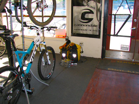
Auburn Bike Works. I am famished; time to fuel up for the last leg of the journey as I expect it will be another 50 miles. My charge is very low – so lots of pedaling will be expected. My lips feel sunburnt. I hit the bathroom to wash my faces and arms from the sweat and grit. Partly clean, I ordered a small Auburn Aloha Pizza: Canadian bacon, pineapple, and cashews, with large water and large apple juice. So far I have only pee’d twice today, but seems like I have drank over two gallons of water. Pizza arrives; looks great, scarf down about 3/4s of it, kill the water and the juice. Time to go!

Map-Auburn-Sac.png

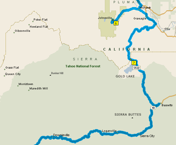
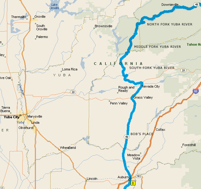
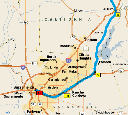
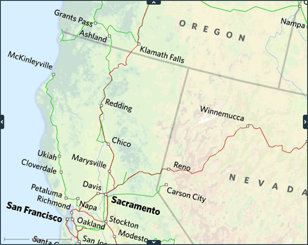
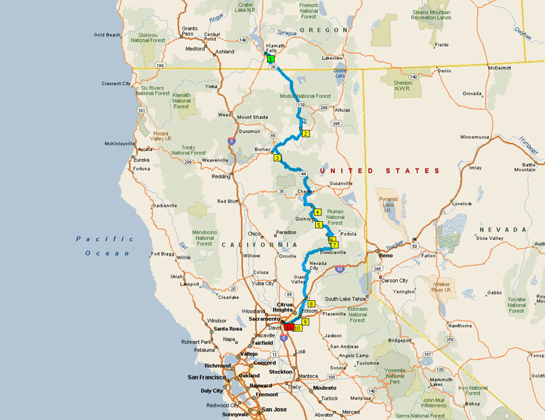
Map: Evening leg of the journey, from Auburn to Sacramento

7:20 PM – Leavin’ Auburn. 405.4 mi, 55.9V, 195.9 Ah. It is near sunset and cooling off, my old nemesis wind is picking up.

This last segment of the ride was by far the most challenging to my spirit more so than it was to my body. I was prepared to accept the heat which is why I worked hard like a dog during the day at the family farm swinging the pickaxe so that I could tell when the onset of dehydration would occur. However I was not prepared to ride in the dark! Now the race was on, to beat the sun down the hill, to conserve power, to push hard - onward using grit and adrenaline – because that’s all I had left to count on.

Leaving Auburn with low volts, I nursed the bike down to Folsom (city) on the Auburn-Folsom Rd down near the American River crossing just below Greenback Lane, near Old Town. A cyclist heading opposite helped me find the American River Bike Trail.

PDF Map of the American River Bike Trail
Another Map of the American River Bike Trail

I took this all the way to Hazel Ave where heavy construction blocked passage. :x :cry: Feeling screwed, I rode north on Hazel up to Winding Way and turned west. After about a mile of this twisty road I pulled off as the final light of day diminished. Using electrical tape I mounted my old bike light previously relegated to flashlight ‘cuz the batts were so weak. But I knew this wouldn’t be enough: My sister gave me a bright LED light that is typically mounted on a ballcap visor; it’s kind of a gag gift if you ask me, but in the dark it frees a hand if you’re trying to read a map or fix something under the hood. Well… this little LED light just became my main Headlight, and I clipped it onto my helmet :roll:

Right. So now with a total of 5 candle-power emitting something like a ¼ watt; at least the drivers can see me coming even if I can’t see squat, though I suppose it’s better than a poke in the eye, or two. Now the sun is completely down, and we are past dusk too. I finished following Winding Way up to Fair Oaks and Sunrise Blvd.

Map-ARBT-0.jpg

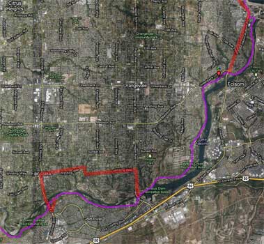
American River Bike Trail - 1st Detour

Completely lost, I asked a guy at a gas station for directions back to the bike path …or if he knew of a faster way to downtown: He says the bike path is the safest and fastest way to downtown, and that I need to take Sunrise south across the bridge to pick up the bike trail again. In doing so I feel quite buggered. :? What am I doing heading SOUTH??? I need to go WEST!!! As soon as I get across the river I see a sign on the other side of the boulevard that says “river access”, so I cross over at the next light and head back north taking the turnoff to the park. As it just so happened a man was chaining up the access to the parking lot; I explained my plight, so he asked me to follow him to the office where he gave me a partial map of the River Trail, and instructs me that I had to take a dirt road down to it. Weary, I am just a little hesitant of dirt roads… but I do so… and immediately got lost. Bugger me! :x I see two headlights moving away so I race in the dark to catch them and ask for help. It was a couple that I had passed earlier: The guy sets me straight, points me correctly, but tells me that I have about 20 miles or more to go to get to Discovery Park. And as an afterthought he adds: “Watch out for the homeless people”. Frack! :shock: The map that I have only has 6 miles of path, up to where the trail crosses over on a bridge from the south to the north side of the river. I’ll have to Braille this. :|

Alone, allow me describe what I see: It’s Pitch Black, like the movie. No moon, but I do have Venus laughing down at me. The ambient glow of the city provides enough contrast that I can distinguish shadow and nothing more. The grass in the park is dry-blond in color during daylight, so there is a slight contrast between the curving paved trail bisected by a washed-out yellow centerline. Between the two piss-poor lights I can dimly see the first 15-20 feet in front of me well enough, but the rest is all by the mask of light pollution. Hey, at least I can see the horizon, what could be worse?

Oh, but there’s more: It turns out the worst part of all is that there are rabbits frozen right beside the path, and then they bolt RIGHT IN FRONT OF THE WHEEL, micro-inches from death, mine I believe, and when this wasn’t jumping out in front of me I had deer and skunks doing the same. In this darkness, I couldn’t go very fast. It was however for the most part level ground and I pulsed through it, curve after curve, dodging tree limbs, swerving to get back onto the path, and damn near sightless. The old rear hub would have failed me here.

At some point after I had traveled unknown miles, daring not to look at the CA in that it might blind my vision, I stopped a cyclist going the other way and asked for directions. First thing he said was “Wow get a load of those tail lights! Man where did you get those?” And he just wouldn’t shut up… On and on bleating way… presumption after presumption… I had to stop him and said “Look, I just want to know how much farther do I need to go to get to the capitol?” So he goes on “Well, it’s maybe two bridges, no – it’s three bridges, but then look left and the trail will go left, but maybe that’s after the second bridge, but you want to look right, then go left, and…” This is the way this guy babbled for the next five minutes. <sigh, shake head> Bored, I reached down and began opening my daypack… slowly – and I could tell he was eyeballing my every move, nervously. As I reached deeply into my day pack, his chatter went higher and higher in pitch. This was a very curious feeling for me, but then I found what I was looking for and I pulled it out… slowly… deliberately… in the darkness of the light, my light, and in the full brightness of his – I unscrewed the cap and drained the entire bottle of water, gulp, gulp, gulp. I put the bottle away, cocked my head and looked in his direction expecting a simple answer to my question when he says “Oh, and there’s a guy sitting on a bench beneath the 2nd bridge; don’t bother asking him for directions as he has Alzheimer’s… or maybe it’s the third bridge, no… it’s the second bridge. Hey didn’t I meet you last week… blah blah blah”. That’s when I asked what time it was and he told me 10:20 PM. “Shit” I says, “So how far is it?!?” He says “Oh maybe 10 miles, maybe less… maybe 7 miles…” And I could tell he was just winding up to get started all over again: I left this chatterbox to entertain himself. Weird!

Map-ARBT-1.jpg

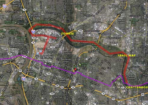
Map: American River Bike Trail - 2nd Detour
Chatterbox was actually a little east of where I have it on the map.

Checking, CA says the batts have 52 volts: I pour it on, darkness or not, I need to get the hell out of this place pronto! Throttle on as much as I dare, I cruised about 5 miles before finding a trailside map without a mileage legend; WTF? At least the visor light was useful. I memorized what I saw, including the landmarks and signage. Chatterbox was wrong: I had passed two bridges already and had another three or four to go. Motor-on.

Then suddenly, underneath the second bridge I came across a guy standing still in the dark slightly off trail who did not acknowledge my passage; he just stood there facing the wall – stone stiff – like, like a Z_O_M_B_I_E ! :shock: Must be the Alzheimer’s guy: Freaky weird, more throttle! Then I saw another guy walking along the side of the path clad in dark clothes; man I just can’t pick these people out until I’m almost right on top of them. Then rustling off to the right; was that another person? I humor myself that it’s The Night of the Living Dead: They can’t catch me if I keep that throttle going! :twisted:

Very soon I figured out that I was in Discovery Park, home for the homeless, and that I was very close to the end. Then the trail took a turn to the right, then right again, up and more right – I was coming out from the basin when boom – there it was – the bridge to the other side. :!: Some homeless gal spoke to me as I passed by but it was foreign tongue; don’t stop - I kept going across the bridge, to bright lights, motels, freeways, cars, and trucks… (sounds like an Eagle's song)

And there I was: At I-5 and Richard’s Road. Boy it has been years since I saw this intersection up close and personal. About 35 years before I had this old beater car; my brother and I had been driving back from who knows what when we had broke down here. Must have waited ½ day in the harsh heat for my Pa to bring a trailer and haul our sorry butts home. Boy has it changed, no longer a scary place; all nice and spiffy. I pull over to the Chevron station and ask for directions and they are not clear at all; I end up going about ½ mile farther down the road before I found someone else to boot me over to another street. Drove over to some City road engineers and they said I was two blocks away. That’s when the bike lost power. I pedal the last block – up the ramp and straight into the station, and parked it right in front of the ticket line.

11:10 PM – Arrived at Sacramento Amtrak Station, 458.0 mi, 42.1V, 210.3 Ah. Total mileage for this day was 173.3 miles.

I was absolutely astounded that I had potentially made it in time. <Yes, yes – ye of little faith…> :roll: Went directly to the Ticket Counter and pleaded my case, and graciously asked not to be turned away (ala Seattle). Upon hearing how far I had traveled, the nice gals made haste to get me on the train, double-doting to be sure. I was shy of serious concern, but those ladies did a fine job, and I never heard boo about the weight of my bike.

All aboard: The train was ½ hour late; we left the station at 12:35 AM.

Next, the Train ride back to Seattle :wink:
 
The Train: I couldn’t sleep for the first hour, but I found a spot and tried to make a nest out of two seats. Slept poorly, and in retrospect should have ordered the Sleeper cabin.

Map-Amtrak-CoastStarlight-SacKFS.png

Map: Amtrak Sacramento to Klamath Falls

About 8 AM – Started charging the batteries. Awake since 5 AM, sometime after leaving Redding, we were heading out of the valley and up the mountains, passing Dunsmuir before daybreak and took about an hour to maneuver around Mount Shasta; truly appreciated all three sides of the view except west.

Charging is going slow. The CA had previously reported that the batteries recovered to about 45.1 Volts but you can’t go more than a block or two with that charge.

As the day wore on, people seated around me became interested in what I was doing. Most were headed to Portland so we had a lot of time to share stories. It was a crackin’ day for traveling; blue skies, through a wide variety of terrain: Desert, high volcanic plains, piney woods, lush rain forest, vast tracts of farmland, and marine biosphere.

Small notes: Walking the length of the train to fetch either food, snack, or view is a lot like being on an old World War II Destroyer running hard through the chop; you need to be nimble, quick on your feet, and go with the flow. I didn’t have any problems; just like being at sea, and those legs came right back to me. Other people were not nearly so fortunate. Also, some Amtrak staff are indeed very courteous, while others - particularly in the food-service-sector have their heads in their trousers stitched way up past their ears. Food bought here is spendy, portions are small, and almost frivolous; bring your own if you can. Water and toilets are free. The average rider is more sophisticated than a bus rider, but less than an airline passenger; many are smokers: I give credit to Amtrak staff for being pretty good about matching seats with smokers and non. Every rider seemed genuinely friendly, sharing fate in the same rattle-trap.

Map-Amtrak-CoastStarlight-SeaKFS.png

Map: Amtrak Klamath Falls to Seattle

4:30PM - After Portland I was mostly alone; all the acquaintances I had made departed.

8:05 PM – Arrived in Seattle.

8:45 PM – Bike is assembled, leaving Amtrak. Stats: 62.8V, 210.3 Ah, 458.0 mi.

9:45 PM – Arrived home to my secret cave in Redmond. Upon leaving Seattle I poured it on WOT to race the sun; it was still daylight when I left, but dimly so when I arrived. No need for Visor-Light. Certainly no need for ZOMBIES !

Final Stats:
  • 547 miles total (counting false starts/missed trains)
  • 256 Ah total, 12798 Watt-Hrs, 26.4 Watt/mi
  • 1.8% Regen, with 4.111 Regen Ah, -13.6 Amin, 32.3 Amax
  • 45.0 MaxS, AveS is bugged (says 290), and Time is bugged (says 1:38:21).

Map-KFS-Sac.jpg

Map of the entire route traveled by ebike, sans Seattle-to-Redmond et al.

Next year I’m taking the 2WD - with hundreds of candlepower! And a watch. And a GPS. :)

You have now arrived at the end of this report of my strange odyssey.
Cheers! Thanks ES for all the help in making this event happen, and for listening! KF

PS - On a somber note: It was brought to my attention late last night that our Old Dog mentioned in this story was put to sleep yesterday; she was over 100 years old in dog-years and had quite the personality. We likes creatures of all sorts - except mosquitoes. From me to you: Hugs to all yer pets.
 
Wonderful story! I lived in Chico for a bunch of years a bunch of years ago. Great photos! Brought back some memories that had faded. Thanks for sharing :D
 
its good you got to spend time with the dog,good run.thats a good haul on faulty equipment,jkg it got you there and back,cant be that bad.thanks for sharing the trip.
 
Kingfish said:
Next year I’m taking the 2WD - with hundreds of candlepower! And a watch. And a GPS. :)

Yeah, no kidding. I wouldn't dare take a trip without taking my laptop, its map software and a USB GPS device. For that matter, I would most likely also purchase cellular internet service.
 
I am planning another bike trip from Washington State down to California this Fall or Winter using the coastal route which has far-lower mountain passes; no need to worry about snow. In the process of this study I came across the Bikely.Com site which has some useful information for getting from Point-A to –B. Then I started using the application to plan out some trips and I discovered I liked it better than the Microsoft MapPoint app that I’ve been using because the Bikely site is for BIKES: You can plan a route to auto-follow roads, or craft one that follows known bike trails which the Google-Map displays. Also as a bonus you can create a graph of the elevation profile which is a huge timesaver. Previously I spent a day or two mapping out the trips in the old way, and now here I’ve gone and mapped out my whole trip both new and old in just a few short hours.

Anyway – here are the links to the routes I took. The Family Farm location is not given, nor is “Bob’s” exactly (though close enough to give an idea of the terrain). However I did note where I took wrong turns (Grass Valley and Sacramento) :oops: :roll:

Day 0: Klamath Falls OR-Burney CA
Day 1: Burney CA-Greenville CA
Day 2: Greenville CA-Plumas-Eureka State Park
Day-X: Plumas-Eureka State Park-Sacramento CA

Graphs:
The elevation profiles are a a cool hat trick! :wink:
To view: Select "Show|Elevation Profile" from their menu bar.

Small comments on comments:
The function of this trip was to determine the limits of the bike/electric system and to evaluate how well I could perform using it. My commuter bike wasn’t meant to take this kind of a long trip; the frame is not designed for touring: The rear hub paid the price, and so did my arse.

With rare exception the whole route was memorized in my head long before I left. It also helped that I was born and raised in California and that I have hiked and camped the high Sierras since I was a squirt. Lastly, because I have family in the foothills, I know many backroads intimately through motorbike: My dead-reckoning and survival skills are spot-on most of the time.

Issues that I didn’t plan on were bad food, wind, goofy charger, provincial assholes on the road, breaking spokes, and traveling at night. But hindsight is 20-20. I will have better equipment for next time around – which is the whole function of testing. :)

The final point I’d like to make is that having a cell phone, a GPS, and any other fancy equipment is all fine and good when they work, but at some point they will fail – and when that happens who are you going to call? How will you sort it out? The early pioneers didn’t have stuff like that, and they forged on through the muck with grit and tenacity. They had horses, I have an electric steed; both have personalities ~ though I think the horse would be more entertaining, and it can feed itself and reproduce! All this technology removes us from what we are: Natural and Human. No, I’ll take chances every chance I get, and let that Indian spirit that dwells within guide me when times are tough. I’ll also be keeping an eye out for Pepsi machines! :mrgreen:

Enjoy, KF
 
Fantastic and fun story. I haven't ventured out for a solo trip like that in years. My nomadic nature was stirred. Thanks for sharing.
 
Back
Top