Backfill #6
Tuesday August 9th Pioneer to Fresno
Technically this is not a backfill since I have not posted the notes before –
but here we go.
")
On this day I faced my toughest test to date in terms of distance, elevation climb, and heat tolerance. The day follows an evening of revere with my Unc & cousins with whom I have enjoyed many off-road experiences. BTW – before I get started here – I just want to say that if you are ever traveling on this part of the country, stop at
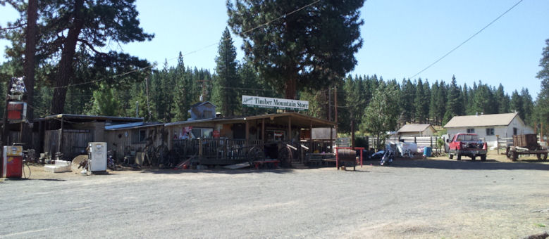
Mr. Beefy’s – a little red shack at the corner of Hwy 26/Red Corral Road & Hwy 88 for the best tasting real ice cream milkshake made in this part of the world! I hear their burgers are just as good! :wink:
Knowing that today’s distance would be even longer than before, I got up and left at
6:40 AM with 63.2V on the pack. Dubious about wearing the fleece, it wound up being a smart idea for protection against wind chill. The short descent to Hwy 88 topped off my pack. Before I knew it I had passed through Pine Grove, and not much later Jackson. Made a left onto Hwy 49 and proceeded south. Traffic was light with no wind.
Hwy 49 though is however known to be hilly, twisty, gusty, narrow, dangerous, though with occasional well-made bypasses around historic towns, and beautiful spans high over canyon reservoirs. This highway begins in Oakhurst (a destination) and runs the length of the California Central Valley foothills, following the major historic artery of the California Gold Rush of 1849, hence Hwy 49, the 49’ner Trail. Last year I took Hwy 49 from Gold Lake Road to Auburn; a long and difficult section. This day would prove even more difficult.
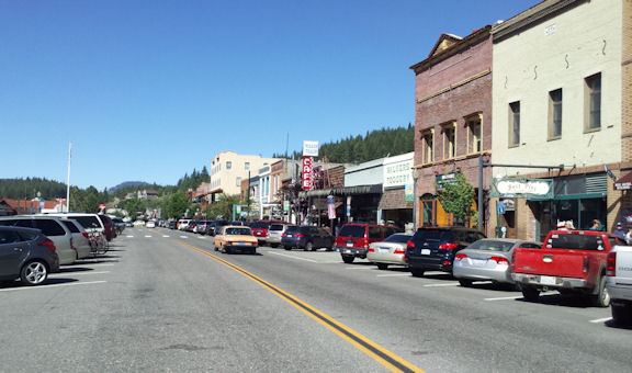
Heading out of Jackson the next town south was San Andreas; traffic was light, though after that it became heavy and snotty all the way into Angel’s Camp and with a headwind that chewed away at my pack. At 8:20 AM after nearly 40 miles I pulled into the Nash Chevron Station in Angel’s camp to rest up and shed the fleece; my hopes were similar to find an outlet. The attendant was curious and we chatted a bit, then I made my pitch to plug in; he pointed to an outlet that was less than 10 feet away and gave me permission to go for it. A tall mechanic named Ethan with ebullient personality was completely enamored by my ebike and quest. He gave me insights on where to eat – and I headed off about 8:30 AM to Rodz Grille. Afterwards I returned and waited about one full hour before pulling the plug and buttoning up. At this time I had 60.0V on the pack which picked up to 61.8V, and noted out of curiosity that the AveS was 31.2 mph.
Left Angel’s Camp at 9:40 AM. The road south was curvy and slow with varying degrees of margin, much of it crowned away from the road and worthless to me. Standing at that Chevron station felt like a blast furnace with the heat reflecting off, though once underway I felt a lot cooler. I soon found Rawhide Road and took that as a bypass around Sonora; Ethan had warned me that there was a fire on that road the day before – and the evidence of that fire was clear, though completely extinguished. This is a winding rural road full of fun and lazy sights – enough entertainment that one could almost forget their road responsibilities. Thankfully traffic was light; I couldn’t imagine going through Sonora as this was blissfully peaceful. So much to explore! Finally the road descends down to Hwys 49 and 108, and I pulled off for a quick check – maybe one minute; all good – let’s roll! 8)
Fast and furious down through Jamestown and down farther to where Hwys 49 and 108 split at Montezuma Road: Another idyllic setting where the mind could wander with so little traffic on this open expanse of foothill plains, This touch of paradise was interrupted by the merge of Hwy 120 at Chinese Camp, although the road is in reasonably good condition with ample margins. Shortly after crossing high over the Tuolumne River at Don Pedro Reservoir I was climbing proudly up out of the river valley, and nearing the crest I noticed the vista view turnout coming up shortly – when I felt this little
bump, then a sound like “
fitz fitz fitz”, followed by a sound of “
flib flib flib” that degenerated into the sound of “
flub flub flub” - <long dramatic pause> - and my worst nightmare had been realized!
 The Flat
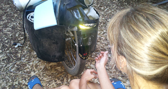
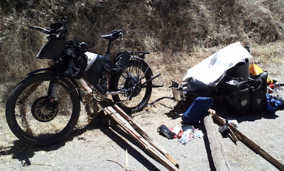
I quickly pulled to a stop as my bike became squirrelly and the rear bike tire deflated. Latex had squirted out everywhere. :x My first impressions were that I had a rim flat like before. Searching for options I pulled my caravan around and onto the access road directly opposite of the Vista View road which had partial shade and hid me from oncoming traffic quite well. I located some dilapidated posts and created a work site that supported the bike and trailer for disassembly – and proceeded to do so.
The time was about 10:45 AM by reckoning, and I had gone about 70 miles downrange. The pack was good and strong – holding at 59.7V. I had shade, water, and food. Though nearly unbearably hot – I had the tools and the ambition to fix this. It took me until 12-Noon to separate the wheel from the bike, which included complete detachment of the trailer, pulling off the torque arms, removing the hitch and washers and nuts and APP-shells. Thank the maker I had installed the Micro-B USB connector for my Halls; no need to cut the connector off. Now I could clearly inspect the wheel, and quickly located the source of the puncture. This is when I called my brother and informed him of my status:
Expect me to be late. :|
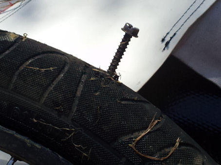
EDIT: Can you believe this was stuck all the way into my tire?
The object stuck into my tire was a ginormous lag bolt, about ¼ inch in diameter by 1-1/2 inch in length. It had been driven straight in, piecing all the way through to the other side of the thick DH tube. Near as I could tell the “Stop Flats 2” just moved aside and let the silly thing pass on through. No amount of foaming latex could plug this hole. Instead the latex congealed on everything it touched including leaves, twigs, spiders and flies, dirt, and who knows what else; it was a nasty mess to clean up before I could begin to make the repair. Frankly – my first thought was that I had been s
abotaged; in the full heat of the day, with my shade disappearing, it is easy for the mind to become muddled and to search for scapegoats. However – the fault is mine alone.
- Always inspect your bike when left in someone else’s care.
- Always keep your eyes on the road for nasties that can cripple your rig. My fault; mine.
I am also going to switch to DOT tires next year. We ride in the worst possible road conditions and it is just plain garbage to deal with. I need better armor. :|
The replacement tube I had on hand is an
Arrow; these are neat tubes that have the metal-stock externally-threaded with nut Schrader valve with is awesome when trying to pump up a deflated tire. The downside is that the tubes are thinner than the Kenda/Q-Tubes DH, though certainly better than the Maxxis. Unfortunately I have a rim-flat that is about a 5mm slit. This I repaired using the traditional sandpaper, smelly glue, and oblong rubber patch. Pray it holds until the next town… With the latex soup still floating around inside the tire – the tube gets stuffed back into the wheel. During this time I had completely lost my shade – though forgot to pay attention. However I did stay hydrated.
Hookworms are difficult to deal with, but I took each challenge one at a time, methodically until each task was completed. Wheel finished. I laid the bike on its’ side to mount it. This is where the Rear Derailleur Hanger became a problem with the missing fastener. I resolved to put the right rear torque arm on to hold the axle in place. Flipped the bike over and repeated the alignment; the axle was in the slot, but not well-seated. Lifted the rear of the bike and dropped it a foot;
boom – in the slot and seated firmly. Got it in one; that was lucky! Dash for the shade, dash for the water. What’s next?

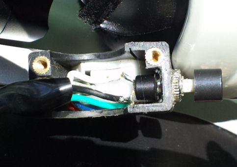
Checked the time and noted my cell phone was low on power so I put power to the auxiliary circuits and plugged my phone into the 12-Volt USB adapter below my dash (finally a chance to use it).
Reattached the left torque arm and hitch. Created a framework from the dilapidated posts to align and support the trailer and bike for re-mating, and got two bolts screwed in; the rest was downhill from here and a matter of buttoning up. The last tasks included putting the rear panniers back on and tying them down – a simple deed and yet I was overheating and could hardly figure out what knot to tie, cursing in the heat. Breathe, relax, focus.
EDIT: Made use of natural assets to leverage my way out of here.
At 2:30 PM I finally had the whole bike repacked, 16 miles to the next town, and ready to go. It has been nearly 4 hours in this miserable heat; I had killed off one whole water bottle and ½ of my Gatorade. Time to go and leave this wretched place. It is now the full-heat of the day, the thing I tried to avoid, and I’m not yet halfway through my journey. Pulled into Coulterville. Actually I blew past it cos there was no shade and it looked like a 2-horse town. Motor-on.
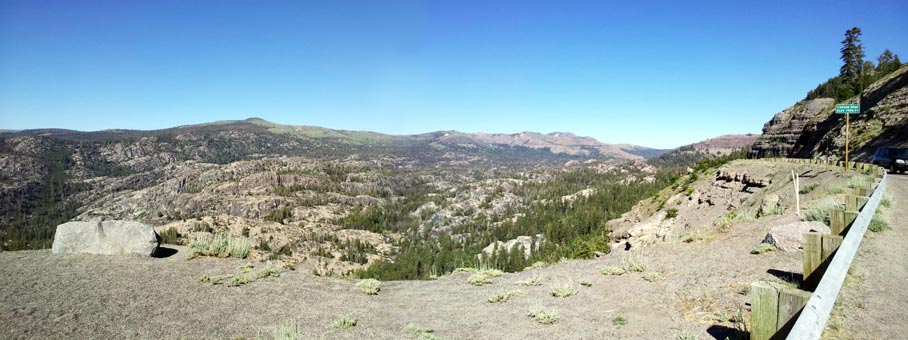
Treeless Desolation
The next stretch of road between Coulterville and the Mariposa County Line is nearly devoid of trees and shade, with two significant mountain passes and several minor ones. The road is slow, winding, with narrow margins and few paved turnouts. However, to my good fortune traffic was light and reasonable, though I had faced hot crosswinds most of the time.
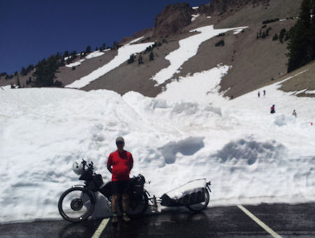
Hugely concerned about power, I switched to the “
poverty-pedaling” technique first tested when climbing over Mt. Lassen. This really helped extend my pack though greatly reduced my climbing speed. Still – I was well into the power band and had no shortage of climbing ability so long as I took it slowly between 24-27 mph. In this segment I found one shady pullout near the top and stopped to eat/drink. There was nothing to lean the bike on, so I had to “
be the pole” and hold it up. From this high vista I could see traffic from two miles out and pace my next departure. Awaiting below was the Merced River gorge. Down and down, over and up, and up some more and out; once across the Mariposa County Line I felt renewed optimism that I might actually survive the day despite the horrific delay. The big unknowns were
How far to Oakhurst, and
How far to Fresno? It was probably best that I didn’t know, though I kept a mental track on the distances to each county line by reading the mileage markers.
Mariposa
Just as I crested the last whopper summit and leveled off, I pulled into the trees for shade and rest. I took a glance at the rear tire and it was almost deflated, indicating leakage. :x Opened up the trailer and extracted the tire pump (which would later live in the rear pannier). Fixed the tire full of pressure. Only 9 miles to go to Mariposa, most of it was downhill. I pulled into the first minimart after Hwy 49 merged with Hwy 140, bought a huge Gatorade and proceeded to kill the whole bottle with a Cliff Bar. Took my empties back into the store and filled them with ice water. Thought about it – and killed another ½ bottle right there. Topped it off again, repacked and got back onto that electric horse and kept going; Time 4:20 PM. No idea how far Oakhurst is – but I poverty-pedal on every significant hill hereafter.
Oakhurst
Between Mariposa and Oakhurst is some quite pretty country that I can really identify with. The road however is quite busy with poor margins; I used the turnouts often to let people by. A remarkable surprise, the township of Ahwahnee is just a spectacular treat to the eyes long starved of lush green trees. Up and over then down into another basin, finally dropping quickly into Oakhurst. Spotted an O’Rielly’s Auto Store, purchased a 16 ounce bottle of
Slime, and injected the whole works into that pesky tire. Called my Bro, let him know where I was and to expect me in 90-120 minutes.
The sun was setting, the heat of the day had past, I had one more major hill to climb, and then it’s all downhill into the anvil of the Valley. Didn’t mark the time, didn’t mark the distance. I didn’t want to know. Only one path lay before me, one task left to accomplish; keep the focus. One foot in front of the other; repeat…
Strangely as it sounds, beginning around Ahwahnee and certainly ascending the last hill coming out of Oakhurst then down into the Valley were signs and indications of public encouragement. People smiled and waited for me; they waved, gave me thumbs-up, shouted encouragements (when I could understand them, or at least I took them to be positive) – and I bombed every downhill before me. The most difficult part of this segment was heading into the sun at dusk with partial shade; hard to find the road.
Though the heat had abated the air was thick and close. Long arse grades both up and down with hugely busy traffic coing in pulses metered by the last stop-light in Oakhurst. Finally the Valley comes into view. My legs had feigned pulled muscles for the last 40 miles, but I keep going. The tendons behind my knees complained like overstretched rubber bands that were about to break, but I kept going. In the distance I espied my last rest stop: A partly shaded park and ride at the junction of Hwys 41 and 145.
I wish, I wish, I wish I had remembered to stop and take pictures after crossing Hwy 41 onto Hwy 145 after resting. This is country where I rambled in my youth, and the vistas unfolded before me vast and deep – penetrating clear to the craggy crests of the Sierras. Now heading east on Hwy 145, my next goal is to reach Friant. Traffic is virtually nil, though the road was as nasty as it was in my youth. Little downdips offered up cool breezes. Cows watched me amble by; I moo’d at them;
Moo!
The last big downhill takes me to Friant. I haven’t been on this road since I was in high school. The sun had set enough to halfway illuminate Friant Dam which holds back Millerton Lake; 13 miles to Fresno. When I was a small kid, maybe 12 years old, I got the bright idea one morning to ride out to Millerton Lake on my Stingray bicycle and convinced a pal to go with me. It was 13 miles. We made the trek just fine. Ate too much ice cream. Ran out of money for soda, but I convinced the operator to connect me to my Mom and pleaded they come get us. No way she said;
you rode out there – you can ride back. We rode back, though about halfway back my Pa came and rescued us. Next time I was better prepared.
Crossing the San Joaquin River here put me into Fresno County; the San Joaquin is the southern-most river of the Central Valley that flows naturally north out to sea – whereas all other rivers south of here have no outlet. Go Right
old young man, onward. Basic now: Follow Friant Road into Fresno. Much has changed, and some has not. The narrow two-lane knarled road of my youth was now a divided 4-lane highway affording wide bike lanes on each side. Gone was the old Ball Ranch and the Tasty-Freeze. Gone were the quaint farm houses. But some of the old dilapidated strips were still there waiting I suppose to be snapped up by some enterprising developer. The road follows a sinuous path through the river bottom; it fills me senses as I can recognize vineyards heavy with fruit, and off in the far distance – horse pastures. I welcome it all in the fading light. One last hill to climb – not very large, hardly worth mentioning – yet in my youth, this was
the killer hill. No need to downshift, I am out of the river bottom. Blazed on past a trio of red-shirted cyclists that did fully not comprehend that they had just been
Kingfish’d.
The City beckons like a dazzling jewel. Two lights to go.
The terminus of Friant Road dumps me onto Blackstone Blvd; this was the old Hwy 41 before the freeway replaced it; they don’t even call it Business 41; it’s just a thicket of lights every quarter to half mile from one end of Fresno to the other. At this end of town is a fairly recent developer’s Mecca of Consumerism called Riverpark Mall. The city can’t grow in this direction any farter unless they can figure out how to grow onto the side of the cliffs without falling into the river below.
I peeked at the CA; the voltage on the pack says I can make it to my Bro’s. I try not to look at the miles. Twilight now as I thread my way through rural routes. It is almost dark when I announce my arrival over the cell phone: “
Open the Gate!”
8:20 PM – Arrival
I started this trip at 6:40 AM - nearly 13.5 hours on the road. About 4 hours were stolen by the flat tire. I am filthy, stinky, sticky, tired, and cramping. My Bro hands me a glass of cold something though I cannot recognize that it is Gatorade, the bottle of which I nearly kill on the spot. I haven’t urinated since I fixed the flat; counting the morning, that’s only twice. I won’t urinate again until the next morning, and even then it is a concentrated dribble. I don’t mean to be gross – it’s just that it took me a day to rehydrate.

After dinner, a jump in the pool, and a shower, I enjoyed two Pacifico’s – then faded into bed. This has been the most difficult segment yet.
Stats:
End V = 54.8 (included one hour charging at Angel’s Camp)
Total Day Miles =
186.6; a new record
Regen = 3.3%
Vmin = 52.9
MaxS = 43.0 mph
AveS = 28.7 mph
Trip Time: 6:23:37
Total Odometer = 1248 miles.
I am 50% of the way through my journey. Yesterday placed an order for two replacement tubes; Q-Tubes DH 24” x 2.4-2.75” from JensonUSA and expect to receive them tomorrow.
Resting for now. Once small repair to make tomorrow. I don’t think that I will have time to post pictures until I get back to Redmond. Sorry guys, I only have two arms.
Thanks for all your support,
KF